Utilizing Drones for Construction
Drones can help your business...
Decrease Expenses
1
2
Improve Efficiency
3
Ensure Safer Worksite Practices
4
Improve Data Accuracy
How are Drones Changing the Industry
Mapping
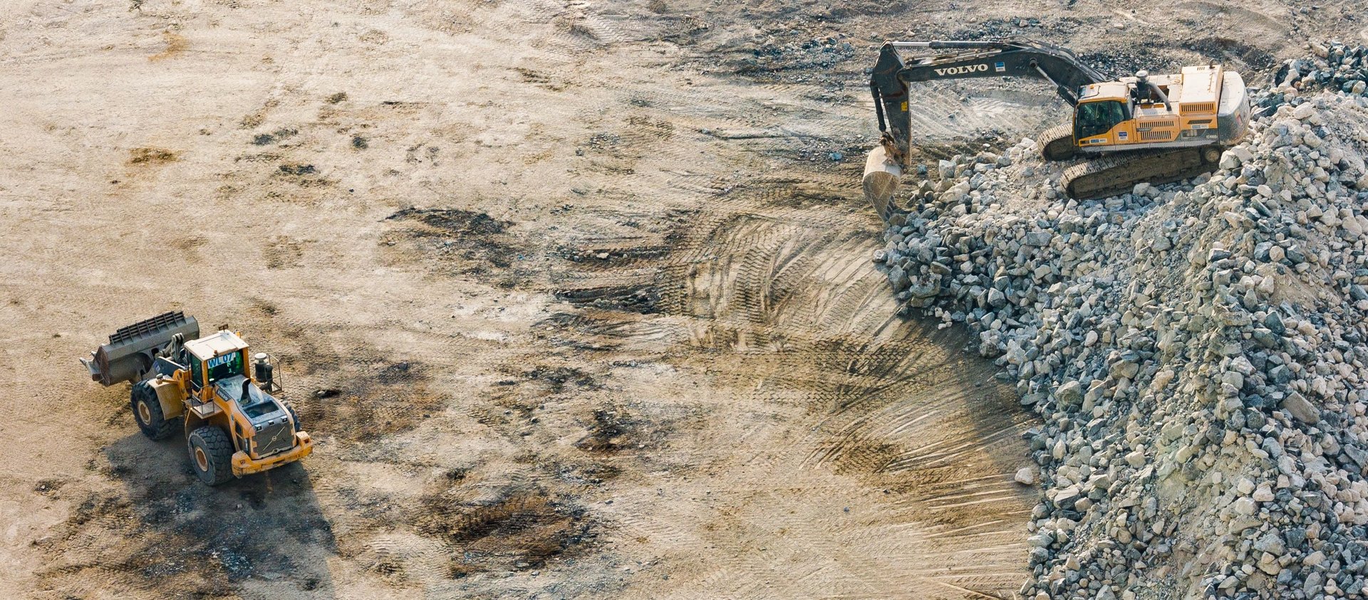
Asset Inventory
Manually surveying a construction site is a long, tedious and expensive process. With use of drones and modern photogrammetry software, we have the ability to accurately 2D & 3D map large areas of land from the air in a much shorter time frame than traditional surveying methods. This results in cost savings, as it cuts down the time spent on site and total manpower required. Due to the increased efficiency of drone mapping, site analysis can be conducted on a regular basis to ensure data is current and accurate.
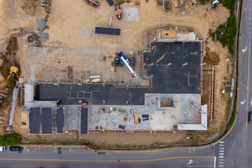
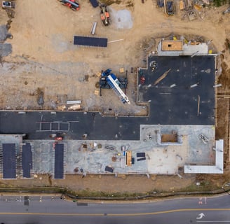
Monitor Progress
Using drone imagery to monitor progress on a construction site can help ensure the project stays on schedule and remains within budget. Visualizing the site from the air can also help construction teams identify and resolve problems before they become costly. Data sets captured at different time points in a project can be used to track the build schedule and can provide a continuous record of the site that can be referenced at any time. Additionally, aerial imagery can provide project managers, contractors and stakeholders the ability to visualize the progression of the project remotely.
Stockpiles on construction sites are constantly changing making it difficult to monitor inventory of materials. Additionally, stockpiles tend to have irregular shapes making it difficult and dangerous to survey with traditional methods. To overcome these difficulties, drones can be deployed to accurately record stockpile volumes via photogrammetry software. Using drones for asset inventory can save time, reduce costs and create a safer work environment.
Safer Inspections
Before drones, workers had to climb or suspend themselves in air to perform inspections on structures. This introduced many potential fall hazards. Drones can be deployed to take high resolution images of these structures and reduce fall hazards while minimizing the amount of time needed to conduct inspections.
Bidding and Pre-Planning
Before beginning work on a construction site, a site analysis is necessary to verify the land is optimal for the proposed project. DTMs, DSMs, orthomosaics, etc. can be created utilizing drone imagery to illustrate drainage spots, vegetation and elevation variation across the site. Having this level of detail will help aid in selecting the best areas for excavating, building and storing materials.
Improved Timelines
Drones have the ability to capture data much faster than traditional means. This reduces the amount of construction site downtime needed for traditional survey efforts. Furthermore, this allows leaders to make important decisions faster. This in turn can help improve project timelines and ensure the clients' expectations are met.
Common Deliverables Provided
Orthomosaic
Digital Elevation Model (DEM)
3D Map
An orthomosaic is a geo-referenced aerial map geometrically corrected for lens distortion, camera tilt, perspective, and topographic relief via photogrammetry. This allows accurate 2D distances to be derived from them. In simpler terms, it's an up to date google earth map with much better clarity and accuracy.
A 3D map is a virtual three dimensional environment produced from overlapping imagery taken from different angles. Once the proper imagery is acquired, photogrammetry software can be utilized to form a point cloud of the scene, which can be triangulated to form 3D maps and models. Accurate 3D distances, areas, and volumes can be deciphered from these outputs.
Digital elevation models (DEM) can be utilized to represent the elevation of the earth's surface. A DEM can either be in the form of a digital terrain model (DTM) or a digital surface model (DSM). A DSM includes all objects on the surface such as trees and buildings. A DTM is very similar to a DSM, with the only difference being it does not include objects on the surface.


